We have worked with organisations across the region to create our flood defence schemes, known as flood alleviation schemes (FAS). These will help build our resilience to climate change and create safer communities. They are also part of our wider Flood Risk Management Strategy. Read the full strategy on Leeds Data Mill.
Flood alleviation schemes under construction
Flood risk studies
Find out how we are assessing options to reduce flood risk around the following areas in Leeds with our flood risk studies (FRS):
Farnley Wood Beck
Leeds City Council has secured funding to carry out a flood risk study and to deliver a flood alleviation scheme to address property flooding from Farnley Wood Beck to properties around Churwell. This beck has caused major flooding in the past.
Area under consideration for the Farnley Wood Beck FRS:
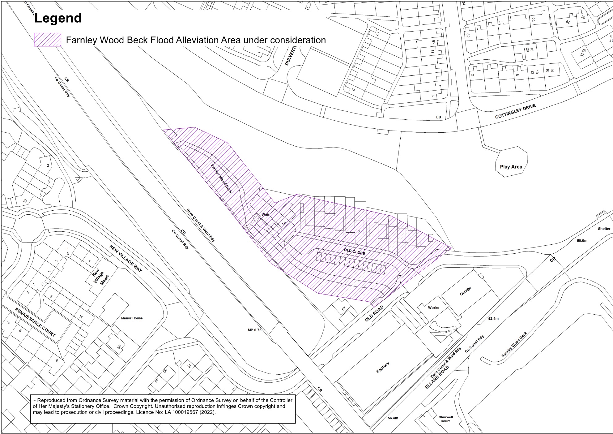
Click map to enlarge.
Find out more and have your say
For more information on the scheme and to have your say on the next round of consultation when it is ready, visit the Farnley Wood Beck FRS Commonplace page.
Contact us
For more information or questions then email us at FRM@leeds.gov.uk and include ‘Farnley Wood Beck FRS' in the subject title.
Meanwood Beck
There have been major flooding events in the Meanwood Beck Catchment in 2002, 2007 and 2015.
Leeds City Council have been working with the Environment Agency to model the Meanwood Beck catchment and identify areas of flood risk.
Area under consideration for the Meanwood Beck FRS:

Click map to enlarge
Find out more and have your say
For more information on the scheme and to have your say on the next round of consultation when it is ready, visit the Meanwood Beck FRS Commonplace page.
Contact us
For more information or questions then email us at FRM@leeds.gov.uk and include ‘Meanwood Beck FRS' in the subject title.
Middle Wharfe Catchment
Areas of Wharfedale including Collingham, Wetherby, Thorp Arch, Boston Spa and Linton have experienced severe flooding in the past, most notably in 2015.
Leeds City Council have secured funding to investigate flood risk across these areas and the wider River Wharfe catchment in Leeds.
As part of this study, we have completed modelling the River Wharfe catchment. This shows the existing level of flood risk and some possible solutions.
Area under consideration for the Middle Wharfe Catchment FRS:

Click map to enlarge
Find out more and have your say
For more information on the scheme and to have your say on the next round of consultation when it is ready, visit the Middle Wharfe Catchment FRS Commonplace page.
Contact us
For more information or questions then email us at FRM@leeds.gov.uk and include ‘Middle Wharfe Catchment FRS' in the subject title.
Potternewton
Due to issues with drainage in the area, Leeds City Council are working with Yorkshire Water, the Environment Agency and WSP to reduce the risk of flooding around Potternewton Park after heavy rain.
The focus is particularly on Newton Road and to the southwest of the park.
Area under consideration for the Potternewton FRS:

Click map to enlarge
Find out more and have your say
For more information on the scheme and to have your say on the next round of consultation when it is ready, visit the Potternewton FRS Commonplace page.
Contact us
For more information or questions then email us at FRM@leeds.gov.uk and include ‘Potternewton FRS' in the subject title.
Thorner Beck
There have been major flooding events in the past from Thorner Beck, particularly in 2007.
A study of Thorner Beck in Thorner and Bramham has been completed this year by the Environment Agency to update flood mapping in the area. This model is available for council use.
The initial phase of the project is to review the modelling and identify the most suitable solution for a flood scheme.
Area under consideration for the Thorner Beck FRS:

Click map to enlarge
Find out more and have your say
For more information on the scheme and to have your say on the next round of consultation when it is ready, visit the Thorner Beck FRS Commonplace page.
Contact us
For more information or questions then email us at FRM@leeds.gov.uk and include ‘Thorner Beck FRS' in the subject title.
Wortley Beck
There have been frequent flooding events from Wortley Beck (also known as Farnley Beck and Hol Beck), most recently in February 2022, affecting the Leeds Ring Road.
Leeds City Council’s flood risk management team are currently working with the Environment Agency to assess the flood risk in the area through various mapping and modelling tools.
Area under consideration for the Wortley Beck FRS:

Click map to enlarge
Find out more and have your say
For more information on the scheme and to have your say on the next round of consultation when it is ready, visit the Wortley Beck FRS Commonplace page.
Contact us
For more information or questions then email us at FRM@leeds.gov.uk and include ‘Wortley Beck FRS' in the subject title.
Completed works
Leeds City Council have worked together with the Environment Agency and other partners on several flood alleviation schemes across the Leeds City Region. You can find details on the schemes that have been completed since 2014, on the timeline on the Leeds City Council Flood Resilience Commonplace page, including:
- Allerton Bywater
- Garforth
- Killingbeck
- Kippax
- Leeds City Centre
- Mickletown
- Otley
Funding
Our schemes are funded by:
- Leeds City Council
-
Defra
-
Regional Growth Fund
-
Leeds City Region Enterprise Partnership
-
Yorkshire Water
- CEG