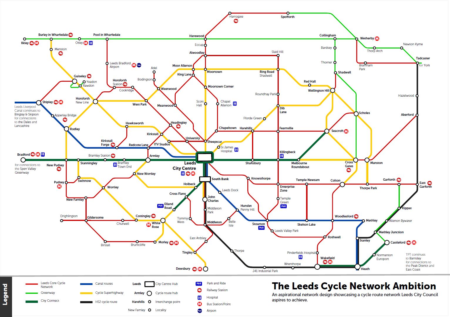
We have developed a strategy in partnership with businesses, charities and the West Yorkshire Combined Authority. You can view the full cycling strategy. It is our ambition to develop a full network of cycle lanes and routes.
We want to keep you updated on how we’re achieving our cycling ambition and strategy.
2016/17 Achieving our cycling ambition statistics
- over 55% of children in Leeds use active methods of transport to school such as cycling, walking scooting
- over 148km of cycle network in Leeds
- over 216 schools in Leeds have good quality cycling storage
- over 700,000 recorded trips on City Connect Cycle Superhighway since opening in 2016
- Cycling Highlights: Completion of City Connect Cycle Superhighway 1+2 - connecting the city centre to East Leeds and Bradford, 12 established bike hubs across the city, creation of Leeds Urban Bike Park and Boddington Fields Circuit (including the Brownlee Centre)
Current works
Safer cycling lanes
In response to the COVID-19 pandemic, Connecting Leeds are implementing trial measures to enable active travel across the city. In the summer of 2020 a public consultation created a map of potential routes and possible locations for cycle lanes.
A660 Otley Road (Headingley)
Work started in September 2020 on the A660 Otley Road to implement cycling between St Anne's Road / A6157 (Headingley) and Victoria Road and in February 2021 for Hyde Park Corner to St Marks Road.
The aim is to create more prominent cycle lanes, segregated where possible, both inbound and outbound along this section of road with high rates of cycling. The lanes will introduce semi-permanent bollards and changes to lining.
You can comment on these proposals.
Roseville Road
Work started in September 2020 on Roseville Road and Gledhow Road to implement cycling between Roundhay Road and Regent Street. The aims are to:
- create safer, segregated cycle lanes both inbound and outbound, where possible, using semi-permanent bollards and changes to lining
- remove the central hatching and islands on Roseville Road to maintain as much parking as possible
- alter the existing angular parking to become parallel parking
- prevent vehicles from using Cross Roseville Road
- introduce new cycle links to allow connections to St James’s Hospital and the wider Harehills area
You can comment on these proposals.
Kirkstall Road
After consultation and discussion with cycling groups and other stakeholders in the city, a section of the cycle lane on the A65 Kirkstall Road from Vesper Walk to the city centre has improved protection for cyclists.
The 3.5 kilometre stretch of road has an existing semi-segregated cycle lane in place, but there are some sections where the cycle access is restricted. In order to help make these sections safer and more welcoming for cyclists to use, the council has installed reflective black and white posts which are secured into a durable rubber base – known as Orca Wands.
South Leeds cycling and walking improvements scheme
We have been working in partnership with the West Yorkshire Combined Authority’s City Connect programme to develop and improve sections of Dewsbury Road and Elland Road to encourage more people to travel on foot and by bike. The proposed improvements support Connecting Leeds' vision for the city, focusing on walking and cycling.
Improvements include:
- more than 4.5 kilometre of new segregated cycle routes
- new and improved crossings
- wider spaces for people on foot and bikes
- improved footway and highway surfaces
Claypit Lane
Segregated cycling and walking route on Claypit Lane is near completion. The work to improve Clay Pit Lane for people travelling by bike and on foot between north Leeds and the city centre includes a 1.3km segregated route between Chapeltown Road and Woodhouse Lane.
The new section will link to existing routes on Meanwood Road and provide people with a safer crossing over the Inner Ring Road.
Importantly, the scheme also includes a new continuous route for people travelling on foot into the northern part of the city centre.
Castleford Greenway – Methley Junction link
As part of the Castleford Greenway, a 1.3 km stretch of traffic-free route and will link the existing National Cycle Network route 67 with Methley Junction.
City Connect
City Connect are building dedicated cycle lanes and improving canal towpaths to make it easier and safer for people to cycle.
The Phase 1 completed schemes include:
- the Leeds to Bradford Cycle Superhighway
- Kirkstall to Shipley Canal Towpath upgrade
- increased cycle parking
- Leeds Community Cycle Hub and Activity Centre
The CS2 superhighway between Leeds City Centre and Seacroft has been completed. The City Connect website has details and progress updates on their current projects.