The Leeds Local Plan includes a Policies Map which shows all the areas in the Leeds district where different policies apply.
The Policies Map will be revised and updated as each Development Plan Document is adopted. As at July 2019 the Policies Map comprises the:
- Saved UDP 2001 and UDP Review 2006 policies
- Natural Resources and Waste Local Plan (adopted January 2013 & revised September 2015)
- Core Strategy (adopted November 2014)
- Aire Valley Leeds Area Action Plan (adopted November 2017)
-
Site Allocations Plan (adopted July 2019, and subsequently amended by High Court decision on 7th August 2020.)
The Policies Map will be updated, where applicable, to reflect the adoption of policies in:
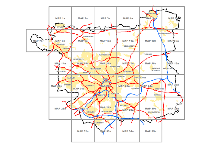
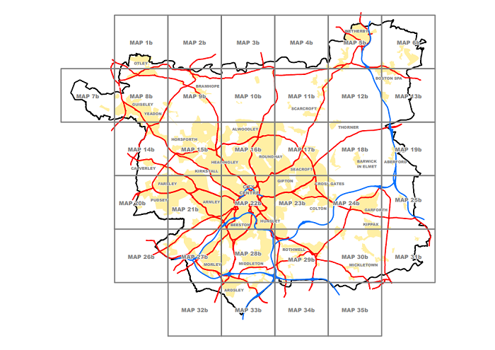
The Policies Map can be viewed and downloaded by clicking on grid squares in the two maps at the bottom of the page. There are too many policy designations to be shown on one single set of maps, so there are there two sets A and B and additional inset maps. The maps should be used in conjunction with the
UDP volume one written statement (PDF 3.1MB),
volume twoAppendices (PDF 1MB) of the UDP Review 2006 (which incorporate saved policies of the UDP 2001), the Core Strategy, the Natural Resources and Waste Local Plan, the Aire Valley Leeds Area Action Plan and the Site Allocations Plan.
The following additional Inset Policies Maps are available:
We suggest you download and print out the two key guides for the maps:
Map A
Map B
© CROWN COPYRIGHT AND DATABASE RIGHTS 2018 ORDNANCE SURVEY 100019567
You are not permitted to copy, Sub-Licence, Distribute or sell any of this Data to third parties in any form.
